
COMMUNITY
- COMMUNITY HOME
- County Judge Brian Miller is sworn-in
- Human remains found in the refuge
- Exploring with SUNFISH
- School bus wreck leads to minor injuries
- Valentine Festival cancelled
- WCT’s variety show a success
- Wakulla Wonderful celebration returns on March 11
- ON THE HORIZON
- LIBRARY NEWS
- BUCKHORN NEWS
- WAKULLA STATION NEWS
- CHAMBER NEWS
Exploring with SUNFISH
Explorer Dr. Robert Ballard is trying out a cave mapping vehicle at Wakulla Springs
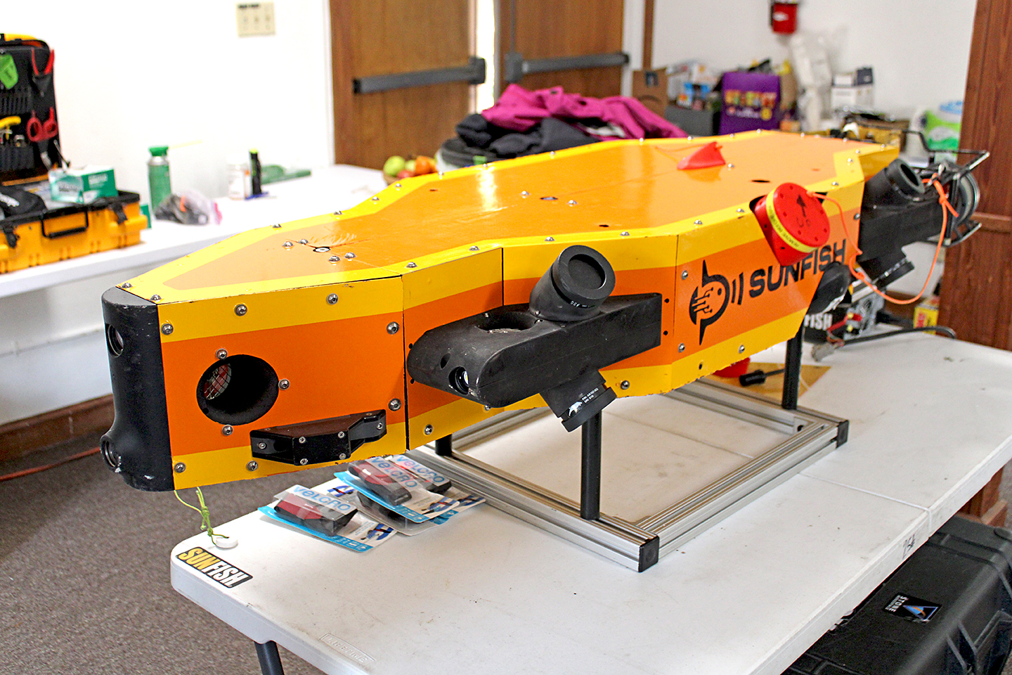
The underwater vehicle SUNFISH. Photos By RIDDHI PATEL
By RIDDHI PATEL Reporter
A mission to test autonomous underwater vehicle (AUV) SUNFISH was carried out over the past two weeks at Wakulla Springs State Park.
The expedition team, led by Dr. Robert Ballard and Dr. William Stone, conducted tests at both Wakulla Spring and Sally Ward Spring between Feb. 1 and Feb. 15 while staying at the historic Wakulla Springs Lodge.
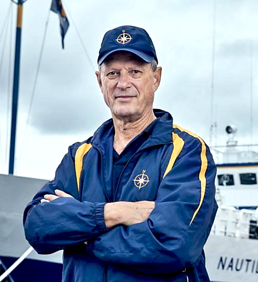
Dr. Robert Ballard, left, and Dr. William Stone right.
The expedition team was composed of explorers, scientists, engineers, divers, and more from Ocean Exploration Trust, SUNFISH, Inc., and Karst Underwater Research.
The SUNFISH testing mission at Wakulla Spring and Sally Ward for the purpose of autonomously exploring and mapping underwater caves is a part of a larger project Ballard is pursuing. Ballard, who is known for his work in underwater archaeology including the discovery and exploration of the RMS Titanic wreck, mentioned that he is currently working on a larger research program called “Walking with the Ancients.”
Through the program, which is sponsored by the Office of Naval Research and National Geographic, Ballard is focused on tracing human migration along coastal routes. His theory was that some of the first Native Americans “walked the shoreline” while migrating across North America thousands of years ago - a theory that has led him and his team to old caves that are submerged, some of which are around 400 ft below sea level.
Ballard noted that some of the caves he is now seeking to study are too deep for divers to reach and safely explore. Expedition leader Jason Fahy said one purpose of AUVs like SUNFISH is to “push past human capability.”
According to the mission director for this testing, SUNFISH Chief Technology Officer Kristof Richmond, the AUV is capable of moving 360 degrees and of thinking for itself. He noted that the AUV is equipped with thrusters, cameras, lights, and sonar. SUNFISH Field Operations Manager Vickie Siegel said that during the early phases of testing the AUV in unstructured underwater caves, it is also sent into the caves with three lines - a communication line, a fiberoptic tether, and a closed-circuit television camera. The lines help individuals on the ground stay connected to the AUV.
Fahy noted that the features of the AUV allow it to both map caves using sonar and acoustics, and map caves through the collection of images. At a special presentation held immediately prior to the Friends of Wakulla Springs monthly board meeting on Wednesday, Feb. 1, SUNFISH developer Stone said, “the vehicle here is acquiring data from the environment by itself, and then it reacts to that and carries out high-level objectives that we give it.” In an interview, Ballard said that the SUNFISH AUV has the ability to create “precise, three-dimensional maps.”
According to Ballard, the SUNFISH team chose Wakulla Springs for this phase of testing and mapping. He noted that the cave system here is interesting in its own right. Ultimately, the goal is to gain confidence in the reliability of SUNFISH to explore and map underwater caves – hopefully at deeper depths.
As SUNFISH is expensive technology, Ballard’s goal at Wakulla Springs was to test it in underwater caves that can be reached by divers in case of any issues that may occur during the mission. He referred to this as “practicing in a cave that divers can reach, so I can put it in a cave divers can’t reach.”
Testing at Wakulla Springs was conducted in two parts. For the first week, the team focused on mapping the Wakulla Spring cave using SUNFISH. Due to limited visibility, these tests focused on using SUNFISH’s sonar capabilities to map the cave. By Feb 8, the team had completed their tests and mapping at the Wakulla Spring cave, and they were starting their tests at Sally Ward Spring.
Sally Ward was included as a testing and mapping site because the water was more clear – thus visibility was better for the divers and AUV. Fahy noted that the focus at Sally Ward was SUNFISH’s ability to map Sally Ward’s cube room using the images that it takes. The ultimate goal for underwater cave mapping using the AUV is to combine sonar mapping with the collected images to create a more complete three-dimensional map of the cave systems.
Fahy said that after mapping is completed, the team hopes to leave behind a product at the Wakulla Springs Lodge that will allow visitors to visualize and experience parts of the local cave system in a more immersive way. The team will be continuing their research on this project with the ultimate goal of mapping deeper caves using the AUV.
For more information you can find a recording of Ballard and Stone’s special presentation on the Wakulla Springs YouTube channel youtube.com/@wakullasprings.